

England
Coast to Coast
Coming soon
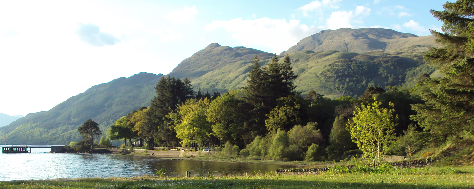
The hard north shore. Roots and rock along Loch Lomond to Inverarnan.
Example stay The Drovers Inn (opens in a new tab)
Cross-check: official Rowardennan to Inverarnan section . We use their settlement names and amenity list as a cross-check. Distances are from our trail geometry, not their mile table.
North of Rowardennan the loch turns remote. The first miles are forestry track. Then the path drops to the shore and gets slow: rock, roots, and short steps. Inversnaid and its waterfall sit about halfway. The hotel is the dependable lunch. Beyond it the ground is the hardest underfoot on the Way. Toward the head of the loch the trees thin and Glen Falloch opens to Beinglas. The Drovers Inn is a short step off the path at Inverarnan.
Start of section
Rowardennan
The hotel, youth hostel, and pier sit on the loch at the foot of Ben Lomond.
The first miles follow a forestry track above the water. It feels easy. Then the path drops to the shore and the footing turns. Between Ptarmigan Lodge and Rowchoish a signed forest road stays higher if you want smoother ground. Both lines meet again before Inversnaid.
Lunch
The Way crosses a footbridge over the falls as they drop into the loch. The hotel sits on the water and is the usual mid-section stop for food. A seasonal waterbus runs from the pier to Tarbet and Inveruglas on the west shore. The RSPB reserve is just beyond the hotel.
Official guidance singles out this shore as the challenging stretch: crags, boulders, and a path that asks for care. Miles take longer than the map. Toward the head of the loch the trees thin and Glen Falloch opens. Beinglas sits on the Way. For the Drovers you leave the path and cross to Inverarnan.
End of section
Inverarnan
Beinglas sits on the Way. The Drovers Inn is a short step off, across the river.
Not a climb. Roots, rock, and slow miles along the north shore. Rannoch Moor is longer and more exposed. The Devil's Staircase is the steep pull. This is the day that takes longer than the map. Most people remember it.
Refreshments
Toilets
Arrive
Rowardennan
No bus. Seasonal waterbus from Tarbet or Luss on the west shore. Walk from the pier.
Leave
Inverarnan
Citylink coaches stop on the A82 at Inverarnan. Beinglas is on the Way. The Drovers is a short step off.
Southbound, you finish at Rowardennan and leave by waterbus.
Opposite direction
If you walk the Way from Fort William to Milngavie, this is the stretch that drops back to Loch Lomond and follows the rocky east shore south. Same roots and rock as the northbound day. Inversnaid is still the middle. Rowardennan is a quiet night at the foot of Ben Lomond.
End of section
Rowardennan
The hotel, youth hostel, and pier sit on the loch at the foot of Ben Lomond.
There is no bus. A seasonal waterbus runs from Tarbet or Luss on the west shore. Walk from the pier to the hotel and hostel. Maps and coordinates are under Get there in Section 3: Rowardennan to Inverarnan overview.
It is the hardest of the eight official sections underfoot. Not a big climb. Roots, rock, and short steps along the north shore, especially after Inversnaid. Miles take longer than the map. Rannoch Moor is longer and more exposed. The Devil's Staircase is the steep pull.
Most people take 6–7 hours, plus a stop at Inversnaid. It is Day 3 on the 6-, 7-, and 8-day itineraries, and Day 4 on the 9-day. The 5-day walks this shore as part of Balmaha to Inverarnan, not as its own day.
Beinglas sits on the signed path. The Drovers Inn is a short step off, across the river at Inverarnan. Most people leave the Way for the inn, then rejoin for the next section toward Tyndrum.
Beinglas (camping, wigwams, food) or the Drovers Inn at Inverarnan. Book ahead in summer. The 5-day also sleeps here, after a longer day from Balmaha.
Yes. Use the GPX button at the top of this page. It is this section's line, for Garmin, Komoot, or your phone. Open the planner if you want a file built around your overnight stops.
Used as Day 3 on the 7-day. Open the planner on that preset, then export a full-trip or per-day GPX.
Open in planner Read the 7-day itinerary
Full-trip and per-day GPX files. Free, no account.
Explore
England

Scotland
Scotland