

England
Coast to Coast
Coming soon
Easy miles out of Milngavie through Mugdock toward Loch Lomond.
Example stay The Drymen Inn (opens in a new tab)
Cross-check: official Milngavie to Drymen section . We use their settlement names and amenity list as a cross-check. Distances are from our trail geometry, not their mile table.
A gentle warm-up out of the suburbs. The path slips through Mugdock Country Park and past a string of small lochs, with the Campsie Fells and Dumgoyne for company. The Beech Tree at Dumgoyne is the natural lunch. Drymen is just off the Way. Most people leave the path for the night and a shop.
Official start
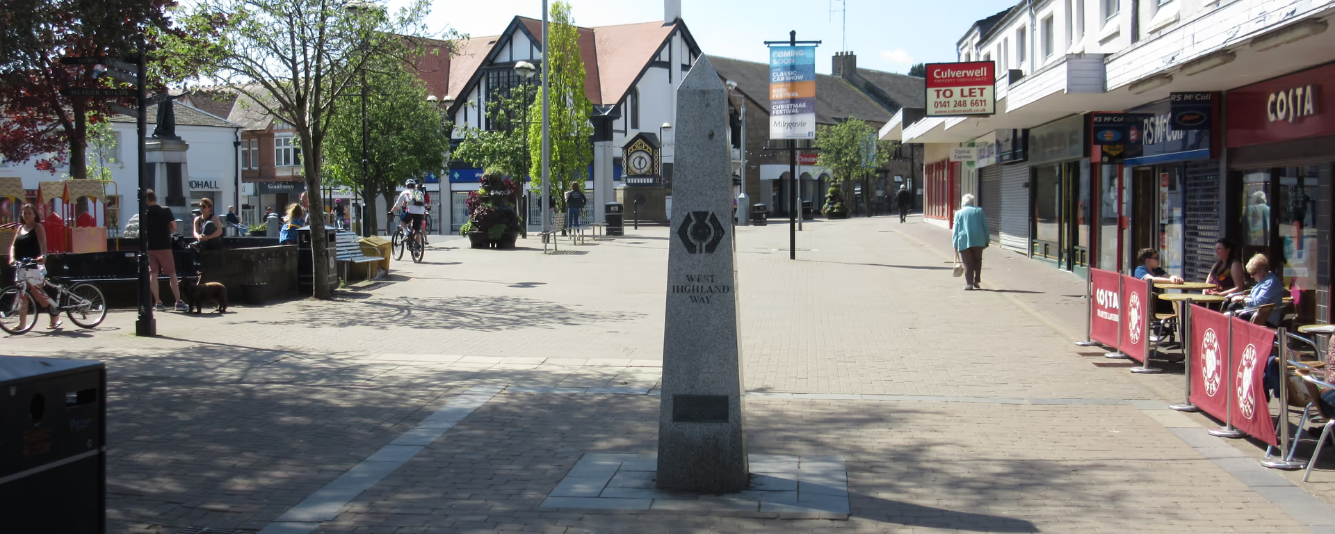
Milngavie obelisk
Official start of the Way. Douglas Street, in the town centre. Last shops and a tap are here before you leave the high street.
The first hour leaves the high street and drops into woods and lochans. Craigallian Loch is the first named water. It feels like a country-park walk, and that is the point: you shake off Glasgow before the hills begin.
Lunch
Dumgoyne is the steep little cone on the Campsies, a landmark rather than a detour. The Beech Tree sits on the path at Dumgoyne and is the usual mid-section stop for food and a tap.
Leave the path
The official route skirts the village and continues toward Balmaha. For a night in Drymen you leave the signed path and walk into the square. The next official section starts when you rejoin.
End of section
Drymen
The signed Way skirts the village. Leave the path for the square: beds, a shop, and buses.
Distance, not technical. The test is a full walking day, not the surface. Tomorrow (or the same day on the 5-day) is Conic Hill and the loch. The north shore of Loch Lomond and Rannoch Moor are the hard sections. This one is the warm-up.
Refreshments
Toilets
Arrive
Milngavie railway station
ScotRail from Glasgow Queen Street, about 25 minutes. Then walk to the obelisk.
Leave
Drymen
Local buses from the square. The Way does not enter the village.
Southbound, you finish at the obelisk and leave from this station.
Opposite direction
If you walk the Way from Fort William to Milngavie, this is your last official section. Same footpaths, tracks, and lanes as the northbound opener, only you are coming down into the suburbs after the hills.
Official finish
Milngavie obelisk
Official finish if you walk south. Douglas Street, in the town centre.
ScotRail from Glasgow Queen Street to Milngavie station, about 25 minutes. Walk along Douglas Street to the granite obelisk. That is the official start, not the station. Maps and coordinates are under Get there in Section 1: Milngavie to Drymen overview.
It is the easiest of the eight official sections. About 11.8 mi (19 km) on footpaths, tracks, and lanes, with no major climb. The test is getting used to a full walking day, not technical ground. Conic Hill and the rocky north shore of Loch Lomond come after Drymen.
Most people take 5–6 hours, plus a lunch stop at Dumgoyne. It is Day 1 on the 6-, 7-, 8-, and 9-day itineraries. The 5-day continues over Conic Hill to Balmaha the same day, so that first day is longer.
The signed path skirts the village. You leave the Way to reach the square for beds, a shop, and buses, then rejoin for the next section toward Balmaha and Rowardennan.
Drymen is the usual first night on the 6- to 9-day splits. Book ahead in summer. The 5-day sleeps in Balmaha instead, after Conic Hill.
Yes. Use the GPX button at the top of this page. It is this section's line, for Garmin, Komoot, or your phone. Open the planner if you want a file built around your overnight stops.
Used as Day 1 on the 7-day. Open the planner on that preset, then export a full-trip or per-day GPX.
Open in planner Read the 7-day itinerary
Full-trip and per-day GPX files. Free, no account.
Explore
England

Scotland
Scotland