

England
Coast to Coast
Coming soon
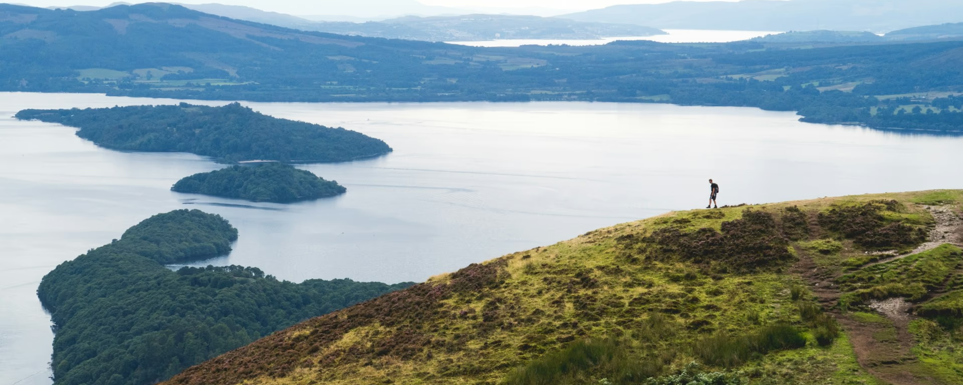
The first real climb at Conic Hill, then the east shore to Rowardennan.
Example stay Rowardennan Hotel (opens in a new tab)
Cross-check: official Drymen to Rowardennan section . We use their settlement names and amenity list as a cross-check. Distances are from our trail geometry, not their mile table.
From Drymen you rejoin the Way and climb through Garadhban Forest to Conic Hill. The signed path rounds the shoulder. A short detour reaches the summit. The view is Loch Lomond and the islands on the Highland Boundary Fault. The drop into Balmaha is steep. After the village the path follows the east shore through oak woods, past Milarrochy, Cashel, and Sallochy, to Rowardennan at the foot of Ben Lomond.
Start of section
Drymen
Rejoin the signed Way from the village. The official path is a short walk from the square.
The climb
The signed Way climbs around the shoulder, not over the top. A short branch reaches the summit if you want the full view: Loch Lomond and the islands lined up on the Highland Boundary Fault. The descent into Balmaha is steep and stepped.
Lunch
The village sits under the hill on the loch. Food, a shop, toilets, and the National Park visitor centre are here. The 9-day sleeps here. On the 6- to 8-day it is the mid-section stop before the east shore.
After Balmaha the Way follows oak woods along the water, rising and falling more than the map suggests. Milarrochy, Cashel, and Sallochy are the named pauses. There is no other village before Rowardennan.
End of section
Rowardennan
The hotel, youth hostel, and pier sit on the loch at the foot of Ben Lomond.
The climb is Conic Hill. The sting is the steep drop into Balmaha, then undulating lochside. The rocky north shore after Rowardennan and Rannoch Moor are the hard sections. This is the first proper hill, not the crux.
Refreshments
Toilets
Arrive
Drymen
Local buses to the square. Rejoin the Way from there.
Leave
Rowardennan
No bus. Seasonal waterbus to Tarbet or Luss on the west shore.
Southbound, you finish in Drymen and leave by bus from the square.
Opposite direction
If you walk the Way from Fort William to Milngavie, this is the stretch that leaves the loch and climbs Conic Hill from Balmaha. Same forest, hill, and shore as the northbound day, only you are dropping toward Drymen and the Lowlands.
End of section
Drymen
The signed Way skirts the village. Leave the path for the square: beds, a shop, and buses.
Local buses to the square. The signed Way does not enter the village. Rejoin from there. Maps and coordinates are under Get there in Section 2: Drymen to Rowardennan overview.
It is a typical official section: one real climb on Conic Hill, then a steep drop into Balmaha and an undulating lochside walk. The rocky north shore after Rowardennan and Rannoch Moor are harder. A signed low-level line avoids the hill when it is closed.
Most people take 7–8 hours, plus a stop in Balmaha. It is Day 2 on the 6-, 7-, and 8-day itineraries. The 9-day splits at Balmaha. The 5-day walks Conic Hill on day 1 and does not sleep in Rowardennan.
The signed path rounds the shoulder. A short detour reaches the summit. If lambing or works close the hill, use the signed line via Milton of Buchanan and the B837 into Balmaha.
Rowardennan is the usual night on the 6- to 8-day splits: hotel, youth hostel, and bunkhouse. Book ahead in summer. The 9-day sleeps in Balmaha first. The 5-day sleeps in Balmaha, then continues past Rowardennan along the north shore.
Yes. Use the GPX button at the top of this page. It is this section's line, for Garmin, Komoot, or your phone. Open the planner if you want a file built around your overnight stops.
Used as Day 2 on the 7-day. Open the planner on that preset, then export a full-trip or per-day GPX.
Open in planner Read the 7-day itinerary
Full-trip and per-day GPX files. Free, no account.
Explore
England

Scotland
Scotland