What is this 7-day itinerary?
Seven days is the Speyside Way at the pace most people walk it, with the long last stretch split by a night at Loch Insh. The first days follow the river up from the sea through whisky country. The one hard day is the forest above the Spey from Ballindalloch to Grantown. Start here if this is your first long walk.
Read the Speyside Way guide for the whole trail.
Will this 7-day split work for you?
- The one to start with. A week by the river, one hard forest day.
- Split finish. Aviemore to Newtonmore over two days.
- Book first: Ballindalloch, then Insh Hall at Kincraig.
Fitness & effort
Good for a first long walk if you can manage a full day on foot two or three times in a row. Most of the ground is level railway track and forest path. The test is Ballindalloch to Grantown, where the path rises and falls through forest and the gates and wet patches make the miles slow. Reserve Ballindalloch first, because it has the fewest beds on the walk.
The 7-day route on the map
Toward Newtonmore
Buckie to Newtonmore in 7 days
Buckie to Newtonmore, upstream from the shingle of Spey Bay through whisky country and the Strathspey pinewoods to the edge of the Cairngorms.
| Day | Stage | Distance | Overnight / destination |
|---|---|---|---|
| Day 1 | Buckie → Fochabers | 11.0 mi (17.6 km) | The Gordon Arms Hotel (opens in a new tab) |
| Day 2 | Fochabers → Craigellachie | 12.6 mi (20.4 km) | The Craigellachie Hotel (opens in a new tab) |
| Day 3 | Craigellachie → Ballindalloch | 11.9 mi (19.1 km) | Cragganmore Lodge (opens in a new tab) |
| Day 4 | Ballindalloch → Grantown-on-Spey | 14.7 mi (23.7 km) | Grant Arms Hotel (opens in a new tab) |
| Day 5 Longest | Grantown-on-Spey → Aviemore | 16.2 mi (26.1 km) | Cairngorm Hotel (opens in a new tab) |
| Day 6 | Aviemore → Kincraig | 7.0 mi (11.3 km) | Insh Hall (opens in a new tab) |
| Day 7 | Kincraig → Newtonmore | 13.4 mi (21.5 km) | Speyside Way Finish |
-
Day 1
Buckie to Fochabers
11.0 mi (17.6 km) ↑ 70 m (250 ft) ↓ 60 m (200 ft)
A flat start by the sea, so the first day settles you in. The shingle of Spey Bay is the halfway mark, with the café at the Dolphin Centre beside the old salmon ice house. Upstream, the path narrows through woods and along the riverbank, and it twists more than the map suggests. Fochabers, a planned village of the 1770s, is at the top of the bank.
Example stay The Gordon Arms Hotel (opens in a new tab)
-
Day 2
Fochabers to Craigellachie
12.6 mi (20.4 km) ↑ 490 m (1,600 ft) ↓ 440 m (1,450 ft)
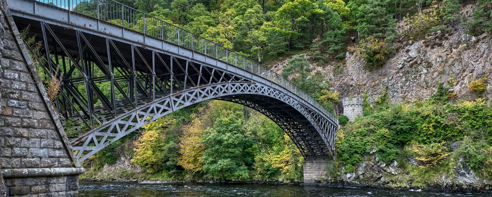
The first climb of the week: Ben Aigan, after a long run of quiet road that is quick going but hard on the feet. The forest track is steady rather than steep, and the view opens north down the valley you have walked. Take food for the day from Fochabers, because there is nothing to buy until Craigellachie and Telford's iron bridge over the Spey.
Example stay The Craigellachie Hotel (opens in a new tab)
-
Day 3
Craigellachie to Ballindalloch
11.9 mi (19.1 km) ↑ 190 m (600 ft) ↓ 140 m (450 ft)
The easiest walking of the week, all on the level bed of the old whisky railway. Aberlour is three kilometres in, with cafés and its distillery, so this is the day to linger. The trackbed swaps banks at Bridge of Carron and comes back over the Spey on the Ballindalloch Viaduct. The night's beds at Cragganmore are a short walk from the old station.
Example stay Cragganmore Lodge (opens in a new tab)
-
Day 4
Ballindalloch to Grantown-on-Spey
14.7 mi (23.7 km) ↑ 550 m (1,800 ft) ↓ 470 m (1,550 ft)
The slowest day of the week, though only 14.7 mi (23.7 km). The path climbs into the forest above the Spey and stays there, with stiff pitches, boardwalks and gate after gate. Pack lunch and water from Aberlour or the filling station, as there is no shop until Grantown. The Way crosses the river at Cromdale, where a Jacobite camp was routed at dawn in 1690.
Example stay Grant Arms Hotel (opens in a new tab)
-
Day 5 Longest
Grantown-on-Spey to Aviemore
16.2 mi (26.1 km) ↑ 210 m (700 ft) ↓ 210 m (700 ft)
The longest day, and one of the easiest: old railway and forest tracks, with the Cairngorms across the fields. Nethy Bridge, with its Telford bridges and old drinking fountain, is the lunch stop. The Abernethy pinewoods lead past the osprey centre at Loch Garten. From Boat of Garten the path runs beside the steam railway into Aviemore, the place to stock up for the last two days.
Example stay Cairngorm Hotel (opens in a new tab)
-
Day 6
Aviemore to Kincraig
7.0 mi (11.3 km) ↑ 110 m (350 ft) ↓ 100 m (350 ft)
A short day to rest the legs, before the finish. The path runs gently beside the main railway through open woodland and grassland to Kincraig, where the café at the Old Post Office is the stop. Buy food in Aviemore, because the village has no shop, and arrange your evening meal ahead. The night is at Loch Insh, beside the old kirk on its mound above the water.
Example stay Insh Hall (opens in a new tab)
-
Day 7
Kincraig to Newtonmore
13.4 mi (21.5 km) ↑ 280 m (900 ft) ↓ 270 m (900 ft)
The only climbing since Grantown: a few sharp little climbs through the forest past the Uath Lochans. The path drops to the Insh Marshes, where Ruthven Barracks stands roofless on its mound. Kingussie has shops and cafés for lunch. The last miles to Newtonmore are almost flat, and the Highland Folk Museum is at the end.
Finish Speyside Way Finish
Cross-check: Speyside Way route sections . The official route pages give six main sections and the Tomintoul spur, which these plans leave out. Card distances are measured along the trail between the towns. A walk off the path to a bed is extra.
Toward Buckie
Newtonmore to Buckie in 7 days
The same beds, starting under the Cairngorms. The river carries you down through the pinewoods and the distillery villages to the sea at Spey Bay.
| Day | Stage | Distance | Overnight / destination |
|---|---|---|---|
| Day 1 | Newtonmore → Kincraig | 13.4 mi (21.5 km) | Insh Hall (opens in a new tab) |
| Day 2 | Kincraig → Aviemore | 7.0 mi (11.3 km) | Cairngorm Hotel (opens in a new tab) |
| Day 3 Longest | Aviemore → Grantown-on-Spey | 16.2 mi (26.1 km) | Grant Arms Hotel (opens in a new tab) |
| Day 4 | Grantown-on-Spey → Ballindalloch | 14.7 mi (23.7 km) | Cragganmore Lodge (opens in a new tab) |
| Day 5 | Ballindalloch → Craigellachie | 11.9 mi (19.1 km) | The Craigellachie Hotel (opens in a new tab) |
| Day 6 | Craigellachie → Fochabers | 12.6 mi (20.4 km) | The Gordon Arms Hotel (opens in a new tab) |
| Day 7 | Fochabers → Buckie | 11.0 mi (17.6 km) | Buckie |
-
Day 1
Newtonmore to Kincraig
13.4 mi (21.5 km) ↑ 270 m (900 ft) ↓ 280 m (900 ft)
The flat miles out of Newtonmore lead to Ruthven Barracks above the Insh Marshes. Eat in Kingussie, because the forest beyond has a few sharp little climbs before the drop to Loch Insh.
Example stay Insh Hall (opens in a new tab)
-
Day 2
Kincraig to Aviemore
7.0 mi (11.3 km) ↑ 100 m (350 ft) ↓ 110 m (350 ft)
A short day over gentle ground from Loch Insh to Aviemore. The café in Kincraig is the morning stop, and the rest is open woodland beside the railway into the busiest town on the walk.
Example stay Cairngorm Hotel (opens in a new tab)
-
Day 3 Longest
Aviemore to Grantown-on-Spey
16.2 mi (26.1 km) ↑ 210 m (700 ft) ↓ 210 m (700 ft)
The steam railway keeps you company out of Aviemore. Pinewood paths lead past the osprey woods of Loch Garten to lunch at Nethy Bridge, and the last miles to Grantown are easy trackbed across open farmland.
Example stay Grant Arms Hotel (opens in a new tab)
-
Day 4
Grantown-on-Spey to Ballindalloch
14.7 mi (23.7 km) ↑ 470 m (1,550 ft) ↓ 550 m (1,800 ft)
Anagach Woods make a gentle start out of Grantown before the path crosses the Spey at Cromdale and climbs into the forest. The rest is short steep pulls, wet ground and many chain gates, so allow more time than the miles suggest.
Example stay Cragganmore Lodge (opens in a new tab)
-
Day 5
Ballindalloch to Craigellachie
11.9 mi (19.1 km) ↑ 140 m (450 ft) ↓ 190 m (600 ft)
Level railway trackbed all day, with the river close below and two suspension bridges on the way. Aberlour comes late in the walk, so carry something to eat until then.
Example stay The Craigellachie Hotel (opens in a new tab)
-
Day 6
Craigellachie to Fochabers
12.6 mi (20.4 km) ↑ 440 m (1,450 ft) ↓ 490 m (1,600 ft)
The climb round Ben Aigan comes early, through the beech woods of Arndilly. The long run of quiet road after Boat o' Brig is flat but hard underfoot, and the Duke's planned village of Fochabers is at the end of it.
Example stay The Gordon Arms Hotel (opens in a new tab)
-
Day 7
Fochabers to Buckie
11.0 mi (17.6 km) ↑ 60 m (200 ft) ↓ 70 m (250 ft)
The last miles follow the Spey down through narrow riverside woods to the shingle where it meets the sea. Stop at the Dolphin Centre café before the flat coast path and the old railway carry you into Buckie.
Finish Buckie
7-day itinerary FAQ
Is 7 days a good length for the Speyside Way?
Yes, for most people and for a first long walk. It splits the long last section at Loch Insh, so no day is over 16.2 mi (26.1 km). The slowest day is Ballindalloch to Grantown, through forest above the river.
Where does the 7-day split the last section?
At Loch Insh by Kincraig. Aviemore to Newtonmore is 19.5 miles (31.4 km), too long in one go for many walkers, and Kincraig sits about a third of the way along. Insh Hall is on the path just past the village.
Where do I sleep on the 7-day?
Fochabers, Craigellachie, Ballindalloch, Grantown-on-Spey, Aviemore and Kincraig, then Newtonmore at the finish. Ballindalloch fills first, then Kincraig.
Can I get my bag moved on the 7-day?
Yes, from spring to autumn, by a local courier. Ask whether it reaches Kincraig and Newtonmore when you book.
Is there food on every day of the 7-day?
Not on two of them. Fochabers to Craigellachie has nothing on the way, and Ballindalloch to Grantown has no shop until the end, so bring food on days 2 and 4. Kincraig has no shop.
Can I download a GPX for the 7-day Speyside Way?
Yes. Open this itinerary in the planner (free, no account). Download a full-route GPX or per-day files for Garmin, Komoot, or your phone. You can export the preset unchanged or edit overnight stops first.
Personalise this itinerary
This 7-day itinerary is ready as it stands. Open it in the planner to keep these stops, or change where you sleep, then download the GPX for your watch or phone.
Open in planner Back to the comparison
Full-trip and per-day GPX files. Free, no account.
Explore


