- Distance 87.0 mi 140 km
- Duration 5–8 days
- Ascent 1,900 m 6,250 ft
- Descent 1,680 m 5,500 ft
- Difficulty Moderate
What is the Speyside Way?
From the shingle where the Spey meets the Moray Firth to the foot of the Cairngorms. The Speyside Way follows the river 85 miles (137 km) upstream, from the fishing town of Buckie to Newtonmore, much of it on the bed of an old whisky railway.
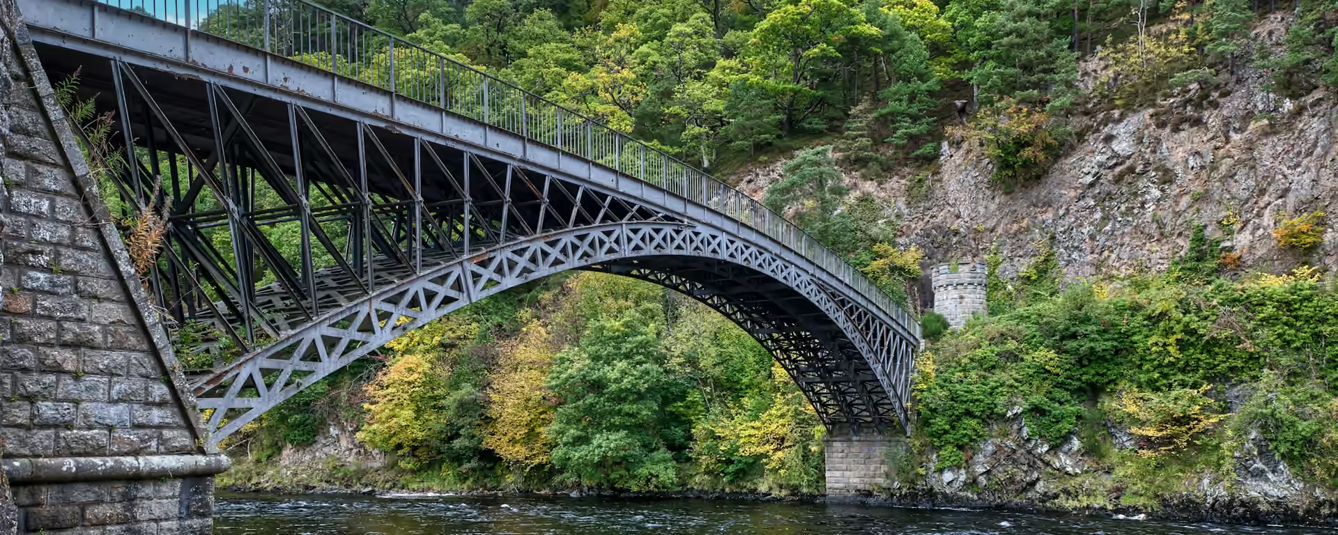
The lower river is whisky country: Telford's iron bridge spans the Spey at Craigellachie, and the old railway runs level and quiet past the distilleries of Aberlour. Beyond Ballindalloch the path climbs into dark forest above the river for the one hard day, then drops to Grantown's 18th-century square.
The upper river belongs to the Cairngorms: ospreys nest in the Caledonian pinewoods by Loch Garten, and the last day passes Ruthven Barracks, roofless on its mound above the marshes. The path is waymarked throughout, so you can keep your eyes on the hills rather than the map.
Speyside Way route map
How hard is the Speyside Way?
It suits a first long walk. Most of the Speyside Way is level railway trackbed, riverside path and forest track, with no high ground on the main line. The slow day is Ballindalloch to Grantown. There the path climbs into forest above the river, and stepping stones, wet patches and many gates slow you down.
No day on the 7-day is over 16.2 mi (26.1 km), and that one runs on old railway that walks quickly. The last section, Aviemore to Newtonmore, is long in one go, and a night at Loch Insh splits it into two easy halves.
The path is waymarked throughout, so you need no navigation beyond watching for the signs. Two days have no food on the way, Fochabers to Craigellachie and Ballindalloch to Grantown, so take food for the day and water on both.
Speyside Way itineraries and official sections
Pick a day count and the 5–8 day splits show where you would sleep each night, or read the route as the official town-to-town sections.
When is the best time to walk it?
- January, winter
- February, winter
- March, fair
- April, good
- May, best
- June, best
- July, good
- August, good
- September, best
- October, fair
- November, winter
- December, winter
Best months: May, June, and September
May, June and September are the months to aim for, with long light, fewer midges than high summer, and the beds and bag service running. July and August are good too, with the longest days and more biting insects in the woods.
April and October are fair walking, with shorter days and a chance the bag service has not started or has stopped for the year. From November to March the path stays open, but daylight is short and the ground boggier, so allow more days.
Rain comes on about 14 to 16 days a month from April to September, and about 20 in winter. Speyside sits in the lee of the Cairngorms and is often drier than that, but pack waterproofs in any month.
Rain days each month:
- January, 20 rain days
- February, 18 rain days
- March, 18 rain days
- April, 15 rain days
- May, 15 rain days
- June, 14 rain days
- July, 16 rain days
- August, 16 rain days
- September, 16 rain days
- October, 20 rain days
- November, 20 rain days
- December, 20 rain days
Driest: June — still 14 rain days.
An average for the north of Scotland, wet west coast included. Speyside, in the lee of the Cairngorms, is usually drier.
How do I get there and back?
Buckie has no railway. Take a train to Elgin, on the line between Inverness and Aberdeen, and a bus from the station to Buckie, checking the times before you travel. From Keith, the other nearby station, it is a taxi.
Newtonmore is on the main line, between Edinburgh and Inverness, so trains stop in the village at the end of the walk. Aviemore, on the same line, is the place to join or leave if you walk only part of the Way.
Local buses between the villages are few. Check any bus before you plan a day around it.
Frequently asked questions
The walk
How long does the Speyside Way take?
About a week. Most people take 6 to 8 days. Seven days, with a night at Loch Insh to split the long last section, suits most walkers, and the plans here run from 5 to 8.
Which direction should I walk?
Either way works. Most walkers start at Buckie, with the short, flat coast days first and the Cairngorms growing ahead. Starting at Newtonmore follows the river down to the sea, usually with the wind behind you.
Getting set
Do I need to book accommodation in advance?
Yes. Most beds are busy in season and some close in winter. Book Ballindalloch first, as it has only a few, then Kincraig and Fochabers. The planner shows which bed it uses each night.
Can I get my bag transferred?
Yes, from spring to autumn. A local courier moves bags from bed to bed along the Way. Ask whether it reaches Kincraig and Newtonmore, and whether your dates are inside its season.
The walk
What is the Tomintoul spur?
A separate branch of 15.6 mi (25.2 km) from Ballindalloch over open moor to Tomintoul, climbing to 570 m. It is a hill day that needs a map and compass in mist, and our plans and GPX leave it out.
Getting set
Are there midges on the Speyside Way?
In summer, yes, and ticks too, though fewer than in much of Scotland. Carry repellent, and check for ticks after the woods and long grass.
Can I wild camp on the Speyside Way?
Yes, under Scotland's access rights, if you camp responsibly and follow the Scottish Outdoor Access Code. There is also an informal camping area at Cragganmore, by the old station at Ballindalloch.
This site & app
Is this the official Speyside Way website?
No. This site helps you plan days, stays and a GPX. For the route itself, notices and contacts, use the official Speyside Way site. Speyside Way official site
Do I need an account?
No. Open a Speyside Way plan and change your stops straight away. An email is only needed if you want a link to carry on editing on another device.
Can I download a GPX of the Speyside Way?
Yes. Open a plan and export the whole trip, or one file per day, for your phone or watch. Each section page also has a GPX of that stretch. The file follows the main Way and leaves out the Tomintoul spur.
Plan your Speyside Way
Choose your dates and pace, adjust overnight stops on the map, then export GPX files built around your route.
Explore


