What is this 8-day itinerary?
The South Downs Way in eight days is the usual first walk, from Winchester to Eastbourne, with the white cliffs kept for the last day. Most people take eight or nine days. Eight puts Devil's Dyke and Ditchling Beacon on one walk, into Lewes, and leaves the Seven Sisters for the day after Alfriston. You sleep at Exton and Buriton, so Butser Hill is a day of its own. Book those two villages, and Cocking, before the rest.
Read the South Downs Way guide for the whole trail.
Will this 8-day split work for you?
- A first full walk. Most people take 8 or 9 days, and this is the 8.
- Walkers who want Butser Hill as its own day, and the Seven Sisters kept for the finish.
- Book Exton, Buriton and Cocking first. The beds are below the ridge, and Cocking has few.
Fitness & effort
You should be comfortable walking about 12 miles (20 km) on a chalk ridge, and happy to do it again the next morning. One day is longer: Steyning to Lewes, over Devil's Dyke and Ditchling Beacon. The trail body says anyone who can walk that sort of day should be fine. The path is waymarked in both directions. Take a map. The hard ground is steep chalk, at Butser, Amberley Mount, Chanctonbury and the cliffs, not a moor that needs a compass all day. Each evening you walk down off the ridge to a bed, and back up in the morning.
Your 8-day route on the map
Toward Eastbourne
Winchester to Eastbourne in 8 days
Winchester to Eastbourne, with the wind more often behind you and the white cliffs at the end.
| Day | Stage | Distance | Overnight / destination |
|---|---|---|---|
| Day 1 | Winchester → Exton | 12.4 mi (20.0 km) | Crossways B&B (opens in a new tab) |
| Day 2 | Exton → Buriton | 13.0 mi (20.9 km) | The Nest Hotel & Restaurant (opens in a new tab) |
| Day 3 | Buriton → Cocking | 10.6 mi (17.1 km) | Manor Farm Campsite and B&B (opens in a new tab) |
| Day 4 | Cocking → Amberley | 12.3 mi (19.8 km) | Amberley Castle (opens in a new tab) |
| Day 5 | Amberley → Steyning | 8.9 mi (14.3 km) | Hill View Bed & Breakfast (opens in a new tab) |
| Day 6 Longest | Steyning → Lewes | 17.7 mi (28.4 km) | Premier Inn Lewes (opens in a new tab) |
| Day 7 | Lewes → Alfriston | 14.3 mi (23.1 km) | The Alfriston Hotel (opens in a new tab) |
| Day 8 | Alfriston → Eastbourne | 11.4 mi (18.3 km) | South Downs Way Finish |
-
Day 1
Winchester to Exton
12.4 mi (20.0 km) ↑ 330 m (1,100 ft) ↓ 300 m (1,000 ft)
Cheesefoot Head is the first wide view, out toward the Solent, and you may hear the ranges at Chilcomb. Beacon Hill is where walkers drop steeply on stiles into the Meon. Exton is the night because this first walk leaves the ridge there. Meonstoke is the next village, and the slow plan sleeps there. Faster plans go on to East Meon. When Exton is full, the bed may be in Warnford. Book the village. After Chilcomb the shops are behind you.
Example stay Crossways B&B (opens in a new tab)
-
Day 2
Exton to Buriton
13.0 mi (20.9 km) ↑ 480 m (1,550 ft) ↓ 390 m (1,300 ft)
Old Winchester Hill, with its Iron Age fort, comes before the cafe at the Sustainability Centre. On this plan the cafe is not the night. The five-day sleeps there. You stay on the ridge above East Meon and climb Butser Hill, the highest point on the Way, then drop through the Queen Elizabeth Country Park. Buriton is below the chalk pits. Book it. When the village is full, the fallback is Petersfield, off the path. Skip this night and Butser sits inside a much longer day.
Example stay The Nest Hotel & Restaurant (opens in a new tab)
-
Day 3
Buriton to Cocking
10.6 mi (17.1 km) ↑ 370 m (1,200 ft) ↓ 420 m (1,400 ft)
From Buriton the ridge runs on, the Weald to the north and the Channel to the south. Harting Down is a dry chalk valley, and South Harting is lunch, not the night. A much slower split sleeps in that village. This one does not. The Devil's Jumps are the burial mounds before you drop off Cocking Hill. Cocking has few beds. Book it with Exton and Buriton. When it is full, the night may be a taxi to Midhurst. Eat at South Harting. The end of the day is a small village.
Example stay Manor Farm Campsite and B&B (opens in a new tab)
-
Day 4
Cocking to Amberley
12.3 mi (19.8 km) ↑ 380 m (1,250 ft) ↓ 440 m (1,450 ft)
This is the wooded day, and the steady one before Amberley Mount. A long climb leads into Charlton Forest and over Bignor Hill, where a Roman road still shows in the turf. Bignor Roman Villa is a short detour, not the line. You drop to the River Arun. Amberley is the halfway point, with a train to London, and it is the night. A faster plan walks through and on to Steyning. Stop here. Tomorrow starts with a steep climb.
Example stay Amberley Castle (opens in a new tab)
-
Day 5
Amberley to Steyning
8.9 mi (14.3 km) ↑ 340 m (1,100 ft) ↓ 200 m (650 ft)
The day opens with the steep climb to Amberley Mount, then chalk grassland. Washington has a pub and a shop, and you walk through. The next pull is Chanctonbury Ring, a circle of beeches on an old fort. Steyning is below those hills, and that is the night, not the other villages in the same valley. Tomorrow is the long day, over Devil's Dyke and Ditchling Beacon, so stop. Eat in Steyning. Do not wander on to the River Adur.
Example stay Hill View Bed & Breakfast (opens in a new tab)
-
Day 6 Longest
Steyning to Lewes
17.7 mi (28.4 km) ↑ 590 m (1,950 ft) ↓ 690 m (2,250 ft)
This is the long day, and it is the one a slower plan splits. You rejoin the ridge, cross Devil's Dyke, pass the Jack and Jill windmills, and climb to Ditchling Beacon, the highest point on the Sussex Downs. One plan stops under the dyke. Another stops at Pyecombe, on the path. This one does neither. Lewes is the old town below, about 3 miles (5 km) off the path, so the walk down is part of the day. Carry food and water. Book Lewes.
Example stay Premier Inn Lewes (opens in a new tab)
-
Day 7
Lewes to Alfriston
14.3 mi (23.1 km) ↑ 510 m (1,650 ft) ↓ 510 m (1,650 ft)
Alfriston is a night so the cliffs stay on their own day. You climb back to the ridge, cross the Greenwich Meridian, and drop to the Ouse. Look for seals in the river before Itford Hill. From there to Alfriston there is barely a tree, and Firle Beacon is a launch for paragliders. Do not push on to Eastbourne. The Seven Sisters are tomorrow. Alfriston has food. Use it before the cliffs.
Example stay The Alfriston Hotel (opens in a new tab)
-
Day 8
Alfriston to Eastbourne
11.4 mi (18.3 km) ↑ 580 m (1,900 ft) ↓ 620 m (2,050 ft)
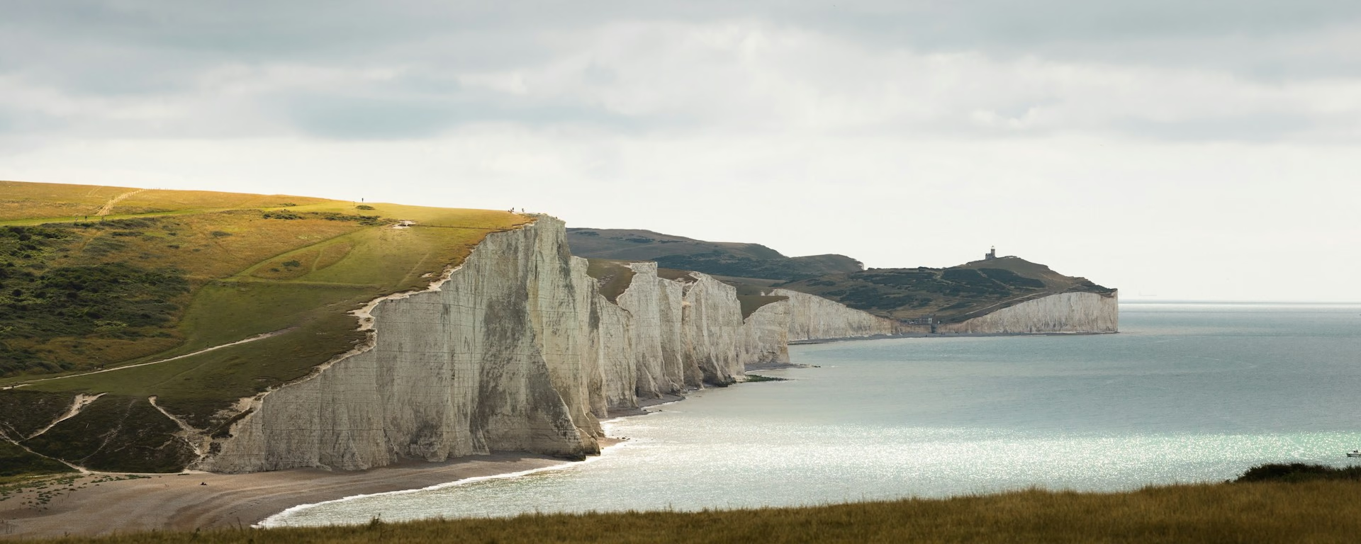
The cliffs are their own day, which is what these eight days keep. Walkers take the footpath by the Cuckmere and over the Seven Sisters, not the bridleway through Jevington. Between Cuckmere Haven and Beachy Head the edge is unprotected and undercut. Stay off it. Birling Gap has a cafe. Beachy Head, Britain's highest chalk cliff, is the last climb, then the promenade at Eastbourne. A faster finish folds the cliffs into a longer day. This plan does not.
Finish South Downs Way Finish
Cross-check: National Trails . Most people take 8 or 9 days to walk the 100 miles (160 km). Distances on the cards are measured on the imported line. The climb printed for cyclists is not the walk.
Toward Winchester
Eastbourne to Winchester in 8 days
The same nights, starting at Eastbourne. The Seven Sisters are the first day.
| Day | Stage | Distance | Overnight / destination |
|---|---|---|---|
| Day 1 | Eastbourne → Alfriston | 11.4 mi (18.3 km) | The Alfriston Hotel (opens in a new tab) |
| Day 2 | Alfriston → Lewes | 14.3 mi (23.1 km) | Premier Inn Lewes (opens in a new tab) |
| Day 3 Longest | Lewes → Steyning | 17.7 mi (28.4 km) | Hill View Bed & Breakfast (opens in a new tab) |
| Day 4 | Steyning → Amberley | 8.9 mi (14.3 km) | Amberley Castle (opens in a new tab) |
| Day 5 | Amberley → Cocking | 12.3 mi (19.8 km) | Manor Farm Campsite and B&B (opens in a new tab) |
| Day 6 | Cocking → Buriton | 10.6 mi (17.1 km) | The Nest Hotel & Restaurant (opens in a new tab) |
| Day 7 | Buriton → Exton | 13.0 mi (20.9 km) | Crossways B&B (opens in a new tab) |
| Day 8 | Exton → Winchester | 12.4 mi (20.0 km) | Winchester |
-
Day 1
Eastbourne to Alfriston
11.4 mi (18.3 km) ↑ 620 m (2,050 ft) ↓ 580 m (1,900 ft)
You leave the promenade and climb Beachy Head first, so the cliff is the morning. The Seven Sisters then run west toward the Cuckmere, still steep and still unprotected. Birling Gap is the pause. Alfriston is the village after the river.
Example stay The Alfriston Hotel (opens in a new tab)
-
Day 2
Alfriston to Lewes
14.3 mi (23.1 km) ↑ 510 m (1,650 ft) ↓ 510 m (1,650 ft)
Firle Beacon is the climb out of Alfriston, and the open crest, with no trees, is the morning. You drop to the Ouse, then the path brings you round toward Lewes. The town is about 3 miles (5 km) off the ridge.
Example stay Premier Inn Lewes (opens in a new tab)
-
Day 3 Longest
Lewes to Steyning
17.7 mi (28.4 km) ↑ 690 m (2,250 ft) ↓ 590 m (1,950 ft)
You climb out of Lewes toward Ditchling Beacon, so the high Sussex ground is the morning. The Jack and Jill windmills come before Devil's Dyke. Steyning is the drop off the hills at the end, and the dyke is behind you by then.
Example stay Hill View Bed & Breakfast (opens in a new tab)
-
Day 4
Steyning to Amberley
8.9 mi (14.3 km) ↑ 200 m (650 ft) ↓ 340 m (1,100 ft)
You climb out of Steyning to the beeches at Chanctonbury Ring. Washington is the village after the descent, pub and shop together. Amberley Mount is then a long drop to the Arun, and the train at Amberley is the finish.
Example stay Amberley Castle (opens in a new tab)
-
Day 5
Amberley to Cocking
12.3 mi (19.8 km) ↑ 440 m (1,450 ft) ↓ 380 m (1,250 ft)
You leave the Arun and climb to Bignor Hill, so the Roman road is the view on the way up. Charlton Forest is the long wooded descent. Cocking is the village under the hill at the end.
Example stay Manor Farm Campsite and B&B (opens in a new tab)
-
Day 6
Cocking to Buriton
10.6 mi (17.1 km) ↑ 420 m (1,400 ft) ↓ 370 m (1,200 ft)
You climb out of Cocking to the ridge. The Devil's Jumps come before Harting Down, and South Harting is still the village off the path. The dry valleys are the walk. Buriton is the drop at the end, down through the chalk pits.
Example stay The Nest Hotel & Restaurant (opens in a new tab)
-
Day 7
Buriton to Exton
13.0 mi (20.9 km) ↑ 390 m (1,300 ft) ↓ 480 m (1,550 ft)
The woods out of Buriton lead up to the country park, and Butser Hill is the climb. East Meon sits below the ridge as you head west. You pass the Sustainability Centre, drop to Whitewool Farm, and finish over Old Winchester Hill into Exton.
Example stay Crossways B&B (opens in a new tab)
-
Day 8
Exton to Winchester
12.4 mi (20.0 km) ↑ 300 m (1,000 ft) ↓ 330 m (1,100 ft)
The steep grass out of Exton is the morning's work, up onto Beacon Hill. After that the tracks run gently back past Cheesefoot Head and Chilcomb. Winchester, with the cathedral and the river, is the finish.
Finish Winchester
8-day itinerary FAQ
Is eight days the right length?
For a first full walk, yes. Most people take 8 or 9 days. Eight keeps Butser Hill as its own day and the Seven Sisters as the last day. Nine adds a night at Pyecombe so Devil's Dyke and Ditchling Beacon are not the same walk. Seven replaces Exton and Buriton with East Meon, and that day to Cocking is the long one.
Which day is the hard one?
Steyning to Lewes. Devil's Dyke, the Jack and Jill windmills and Ditchling Beacon are all on it, and Lewes is about 3 miles (5 km) down off the ridge. The day before ends at Steyning, so you start that ridge fresh. Alfriston comes next, over Firle Beacon, and the cliffs are the day after that.
Do I need to book the nights?
Yes. Beds are limited in places, and you leave the ridge to reach them. Book Exton, Buriton and Cocking first. Warnford is the fallback when Exton is full. Petersfield is the fallback for Buriton, and a taxi to Midhurst when Cocking is full. Lewes is about 3 miles (5 km) off the path, so book it too.
Can I get my bag carried?
Yes. A bag a day is usually £10 to £25, ready in the morning. Ask whether your dates are inside the season. In 2026 the holidays ran to late October. Book the bed before the bag.
Can I download a GPX for the 8-day South Downs Way?
Yes. Open this itinerary in the planner (free, no account). Download a full-route GPX or per-day files for Garmin, Komoot, or your phone. You can export the preset unchanged or edit overnight stops first.
Personalise this itinerary
This 8-day itinerary is ready as it stands. Open it in the planner to keep these stops, or change where you sleep, then download the GPX for your watch or phone.
Open in planner Back to the comparison
Full-trip and per-day GPX files. Free, no account.
Explore


