- Distance 100.7 mi 162 km
- Duration 5–10 days
- Ascent 3,580 m 11,750 ft
- Descent 3,560 m 11,700 ft
- Difficulty Moderate
What is the South Downs Way?
Old droveways follow the chalk ridge, the Weald to the north and the sea coming into view as you walk east. The South Downs Way runs from Winchester to Eastbourne, inside the South Downs National Park.
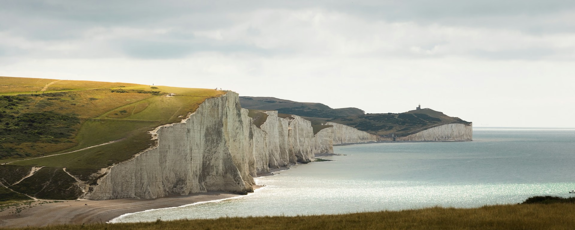
Butser Hill, at 270 m (886 ft), is the highest point on the Way. Devil's Dyke is the largest dry chalk valley in the county. The finish is the Seven Sisters and Beachy Head, Britain's highest chalk cliff.
South Downs Way route map
The full South Downs Way from Winchester to Eastbourne. Tap any day to open that itinerary in the planner and see overnight stops along the way. The panel below the map shows the elevation profile.
How hard is the South Downs Way?
Anyone who is reasonably fit can walk it, if a day of 12 miles (20 km) feels comfortable. The path is waymarked with the acorn, in both directions. Carry a map or a guidebook. This is not a moor that needs a compass all day, and the phone is generally good on the open ridge.
The work is the steep chalk, and the walk down off the ridge to a bed. Butser Hill, Beacon Hill above Exton, Amberley Mount, Chanctonbury Ring, and the cliffs from Cuckmere Haven to Beachy Head are the steep ground. On the usual eight-day, the long day runs from Steyning to Lewes, over Devil's Dyke and Ditchling Beacon.
Most people take 8 or 9 days. These plans are 5 to 10 walking days, and 8 is the usual first walk. Food and shops are mostly off the path, so carry water, and purify anything from a stream. There is no right to wild camp. Ask the landowner.
South Downs Way itineraries and official sections
Pick a day count and the 5–10 day splits show where you would sleep each night, or read the route as the official town-to-town sections.
When is the best time to walk the South Downs Way?
- January, good
- February, good
- March, good
- April, good
- May, best
- June, best
- July, fair
- August, fair
- September, best
- October, good
- November, good
- December, good
Best months: May, June, and September
The path is open all year, and it can be enjoyed at any time of the year. May, June and September are the first-timer months. It is busier in the school holidays and on weekends from May to September.
July and August sit in that busy window, so book the bed ahead. April and October are good months to walk. November through March stay open. The days are shorter, and the steep chalk does not go away.
The chalk drains and dries quickly, which is why it is a good walk outside summer. Southern England still has wet days in every month, and more of them from October through February. Carry waterproofs. The bars are that record, not a forecast.
Rain days each month:
- January, 13 rain days
- February, 11 rain days
- March, 10 rain days
- April, 10 rain days
- May, 9 rain days
- June, 9 rain days
- July, 9 rain days
- August, 10 rain days
- September, 9 rain days
- October, 12 rain days
- November, 13 rain days
- December, 13 rain days
Driest: May, June, July, and September — still 9 rain days.
Southern England averages, 1991 to 2020. The South Downs sit in this district. This is the record, not a forecast.
How do I get there and back?
Long-distance walkers get back by train between Eastbourne and Winchester. Gatwick is the airport link for Eastbourne. Southampton Airport station is the rail link for Winchester. Ferries arrive at Newhaven or Portsmouth.
Times change through the year, so check National Rail and Traveline. Buses across the National Park are on the park authority's site. For a car left in Winchester or Eastbourne, ask the local authority. The car parks are often small.
Frequently asked questions
The walk
How long does the South Downs Way take?
Most people take 8 or 9 days. These plans are 5 to 10 walking days, and 8 is the usual first walk. Five puts the cliffs on the last day. Ten keeps the days shorter, with a night at Poynings under Devil's Dyke.
Which direction should I walk?
Walk from Winchester to Eastbourne. The Trail Officer recommends that way: the wind is likely behind you, and the white cliffs come at the end. The official guidebook is written the other way, and both directions are signed. These plans start at Winchester. The planner reverses them, so the Seven Sisters become the first day.
Getting set
Do I need to book accommodation in advance?
Yes. Book in advance. Beds are limited in some villages below the ridge, and weekends from May to September, plus the school holidays, are the busy time. Book Cocking on every plan. It has few beds, and a taxi to Midhurst is the fallback when it is full. East Meon, on the 6-day, the 7-day and the 10-day, is a campsite. Lewes is about 3 miles (5 km) off the path. The 5-day sleeps at the Sustainability Centre and at Housedean, and does not go down into Lewes.
Can I get my bag transferred?
Yes, once the bed is booked. A bag a day is usually £10 to £25. Have it ready in the morning, and ask whether a van is running on your dates. In 2026 the holidays ran to late October. You still carry water, waterproofs and a spare layer.
This site & app
Is this the official South Downs Way website?
No. This site helps you plan days, stays and a GPX. For trail notices, diversions and official advice, use the South Downs Way pages on National Trails. South Downs Way on National Trails
Do I need an account?
No. A South Downs Way plan opens without an account. Add an email only when you want an edit link on another phone. Downloading a GPX does not need email.
Can I download a GPX of the South Downs Way?
Yes. Open a plan and export the whole trip, or one file per day, for your phone. Each section page also has a GPX of that stretch. The file follows the walkers' line over the Seven Sisters. The Jevington bridleway, 8.5 miles (13.7 km), is a different path.
Plan your South Downs Way
Choose your dates and pace, adjust overnight stops on the map, then export GPX files built around your route.
Explore


