
What is this 8-day itinerary?
Eight days on the Hadrian's Wall Path is the seven-day walk with one road day cut in half. East Wallhouses sits between Heddon-on-the-Wall and Chollerford, so the Military Road is two mornings instead of the longest day of the week. Housesteads and Windshields still have a day of their own, and Brampton still breaks the walk into Carlisle.
Read the Hadrian's Wall Path guide for the whole trail.
Will this 8-day split work for you?
- The 7-day walk with the Military Road broken in two, for anyone who wants that road day shorter.
- Walkers who still want the crags as their own day, and Brampton between Gilsland and Carlisle.
- The Solway finish stays one day. The 9-day plan is the one that adds Boustead Hill.
Fitness & effort
Reasonably fit is enough, and the week is kinder than the seven-day because the road beside the B6318 is split. The switchback from Chollerford to Gilsland is still there, in two days, with little shade and short climbs. A map is worth carrying. The phone signal fades on the central section. The long walk of this plan is the flat last day, and that one asks for a tide check rather than for fitness.
Your 8-day route on the map
Guidebook direction
Wallsend to Bowness-on-Solway in 8 days
East to west, Wallsend to Bowness-on-Solway, the way the official guidebook is written. On-trail distances from our geometry. The walk from the path to the door is not included.
| Day | Stage | Distance | Overnight / destination |
|---|---|---|---|
| Day 1 | Wallsend → Heddon-on-the-Wall | 14.7 mi (23.6 km) | Heddon Lodge |
| Day 2 | Heddon-on-the-Wall → East Wallhouses | 7.4 mi (12.0 km) | Wallhouses South Farm Cottage (opens in a new tab) |
| Day 3 | East Wallhouses → Chollerford | 9.0 mi (14.4 km) | George Hotel (opens in a new tab) |
| Day 4 | Chollerford → Once Brewed | 12.0 mi (19.3 km) | Vallum Lodge Hotel (opens in a new tab) |
| Day 5 | Once Brewed → Gilsland | 8.6 mi (13.8 km) | Dacre House (opens in a new tab) |
| Day 6 | Gilsland → Brampton | 7.4 mi (12.0 km) | Scotch Arms Mews B&B/Holiday Home (opens in a new tab) |
| Day 7 | Brampton → Carlisle | 10.9 mi (17.5 km) | Carlisle Station Hotel | Sure Collection by Best Western (opens in a new tab) |
| Day 8 Longest | Carlisle → Bowness-on-Solway | 15.5 mi (24.9 km) | Hadrian's Wall Path Finish |
-
Day 1
Wallsend to Heddon-on-the-Wall
14.7 mi (23.6 km) ↑ 290 m (950 ft) ↓ 230 m (750 ft)
The week still opens at Segedunum, on pavement through Newcastle: quayside, Baltic, bridges, and coal-boat ribs in the mud at low tide. Stephenson's cottage is half a mile off the Wylam Waggonway. Heddon is the first village. The night that makes this plan different is the next one, at East Wallhouses, not a shorter city day.
Example stay Heddon Lodge
-
Day 2
Heddon-on-the-Wall to East Wallhouses
7.4 mi (12.0 km) ↑ 240 m (800 ft) ↓ 160 m (500 ft)
Field edges and the ditch on the north side of the B6318, which is General Wade's Military Road, with the Wall buried under it. Little climb. You leave the path for East Wallhouses instead of continuing to Chollerford, and the bed is a short walk off the line. This morning does not exist on the seven-day plan. It is the whole point of the eight.
Example stay Wallhouses South Farm Cottage (opens in a new tab)
-
Day 3
East Wallhouses to Chollerford
9.0 mi (14.4 km) ↑ 200 m (650 ft) ↓ 300 m (1,000 ft)
The second half of that same road: more field edges, the same ditch, the odd Roman stone in the bank, and traffic alongside. Chesters waits at Chollerford. Tomorrow the pasture rises and the switchback begins. Because East Wallhouses took the first half, this is a finish to the road rather than the long day it is on the seven-day plan.
Example stay George Hotel (opens in a new tab)
-
Day 4
Chollerford to Once Brewed
12.0 mi (19.3 km) ↑ 650 m (2,150 ft) ↓ 460 m (1,500 ft)
Higher ground after Chesters, Vallum and north ditch clear, then the switchback, tougher than it looks and short of shade. Housesteads sits on the escarpment, so leave time for it. Once Brewed has the beds. Steel Rigg is the car park just beyond. The road is already done, in two pieces, which leaves this day for the first of the crags.
Example stay Vallum Lodge Hotel (opens in a new tab)
-
Day 5
Once Brewed to Gilsland
8.6 mi (13.8 km) ↑ 430 m (1,400 ft) ↓ 560 m (1,850 ft)
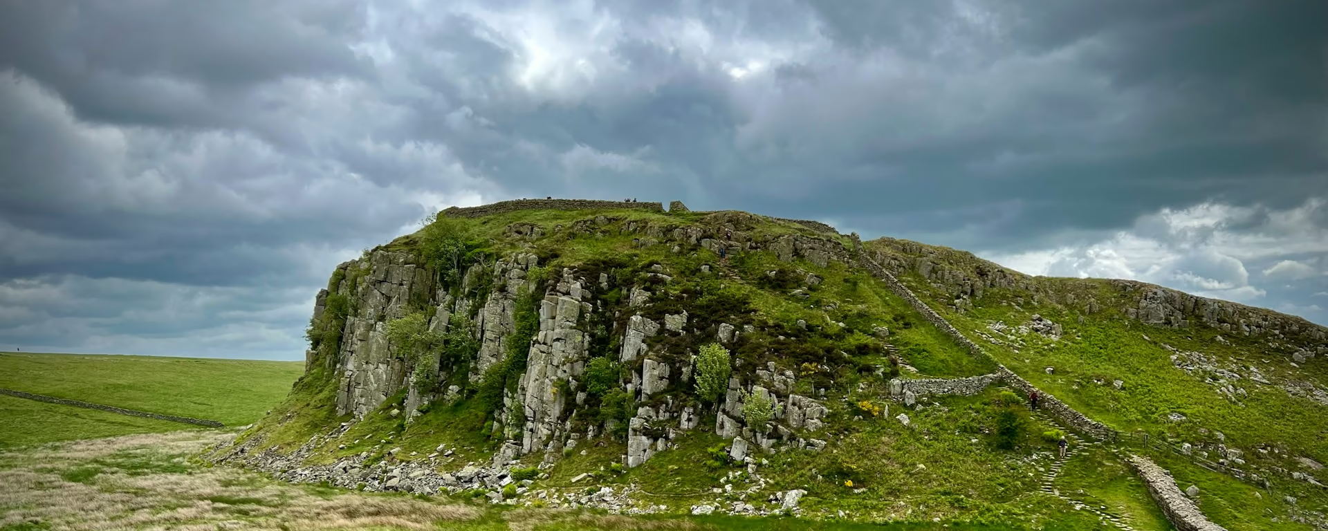
Windshields Crags is the top, 1,131 ft (345 m). From Walltown, a clear day shows southern Scotland, the north Pennines and Bowness-on-Solway. Greenhead is the place to eat. The Wall along here is the standing one, not the stones in a road bank. Gilsland keeps this stretch as its own day, the same job it has on the seven-day plan.
Example stay Dacre House (opens in a new tab)
-
Day 6
Gilsland to Brampton
7.4 mi (12.0 km) ↑ 210 m (700 ft) ↓ 280 m (900 ft)
Birdoswald just west of Gilsland, then Hare Hill, the last standing Wall when you walk west. From there you turn off to Brampton, the market town, and the bed is off the path. Eight days keeps this break. The six-day plan walks past it and stays on the Wall until Carlisle. The hamlet at the turn has very few beds, which is why the night is the town.
Example stay Scotch Arms Mews B&B/Holiday Home (opens in a new tab)
-
Day 7
Brampton to Carlisle
10.9 mi (17.5 km) ↑ 160 m (500 ft) ↓ 190 m (600 ft)
Rejoin the path near sea level. Ditch and ridge in the fields, a little woodland, then the Eden into Carlisle. Quiet walking after the town detour, and the second half of a day shorter plans push through from Gilsland. Use the city for a proper meal and for anything the marshes will not sell you.
Example stay Carlisle Station Hotel | Sure Collection by Best Western (opens in a new tab)
-
Day 8 Longest
Carlisle to Bowness-on-Solway
15.5 mi (24.9 km) ↑ 200 m (650 ft) ↓ 200 m (650 ft)
The Eden, the marshes, and Scotland across the Solway, with barely a climb. This is the long day of the eight, and it is flat. Dykesfield to Drumburgh can flood, and so can Port Carlisle to Bowness-on-Solway, on a Silloth tide of 9 metres or more. Give it an hour either side and check before Carlisle. The nine-day plan stops at Boustead Hill. This plan walks the estuary in one day. The King's Arms has the last passport stamp.
Finish Hadrian's Wall Path Finish
Cross-check: National Trails route description . The walking on this page follows that description. Distances on the cards are measured on our line.
Weather behind you
Bowness-on-Solway to Wallsend in 8 days
Same nights, starting at Bowness-on-Solway. The weather usually sits behind you, and the crags face the other way. The last walking day ends at Wallsend.
| Day | Stage | Distance | Overnight / destination |
|---|---|---|---|
| Day 1 Longest | Bowness-on-Solway → Carlisle | 15.5 mi (24.9 km) | Carlisle Station Hotel | Sure Collection by Best Western (opens in a new tab) |
| Day 2 | Carlisle → Brampton | 10.9 mi (17.5 km) | Scotch Arms Mews B&B/Holiday Home (opens in a new tab) |
| Day 3 | Brampton → Gilsland | 7.4 mi (12.0 km) | Dacre House (opens in a new tab) |
| Day 4 | Gilsland → Once Brewed | 8.6 mi (13.8 km) | Vallum Lodge Hotel (opens in a new tab) |
| Day 5 | Once Brewed → Chollerford | 12.0 mi (19.3 km) | George Hotel (opens in a new tab) |
| Day 6 | Chollerford → East Wallhouses | 9.0 mi (14.4 km) | Wallhouses South Farm Cottage (opens in a new tab) |
| Day 7 | East Wallhouses → Heddon-on-the-Wall | 7.4 mi (12.0 km) | Heddon Lodge |
| Day 8 | Heddon-on-the-Wall → Wallsend | 14.7 mi (23.6 km) | Wallsend |
-
Day 1 Longest
Bowness-on-Solway to Carlisle
15.5 mi (24.9 km) ↑ 200 m (650 ft) ↓ 200 m (650 ft)
Check the tide before you leave Bowness. The path through Port Carlisle, and the marshes back toward Drumburgh, can flood on a high tide. Then the flat estuary, Scotland behind you, and the Eden into Carlisle. Little climb. The city is where the buried Wall takes over from the shore.
Example stay Carlisle Station Hotel | Sure Collection by Best Western (opens in a new tab)
-
Day 2
Carlisle to Brampton
10.9 mi (17.5 km) ↑ 190 m (600 ft) ↓ 160 m (500 ft)
The Eden first, out of the city, then field paths and the buried line. Gentle, with a little woodland. You leave the path again for Brampton, the market town, before the day reaches the last standing Wall at Hare Hill.
Example stay Scotch Arms Mews B&B/Holiday Home (opens in a new tab)
-
Day 3
Brampton to Gilsland
7.4 mi (12.0 km) ↑ 280 m (900 ft) ↓ 210 m (700 ft)
A walk back up to the Wall from the market town, then Hare Hill and Birdoswald, so the last standing stones and the fort come at the end. The day is short. The crags begin once you are through Gilsland.
Example stay Dacre House (opens in a new tab)
-
Day 4
Gilsland to Once Brewed
8.6 mi (13.8 km) ↑ 560 m (1,850 ft) ↓ 430 m (1,400 ft)
Walltown's view comes first on a clear day: Scotland, the Pennines, and the Solway. Then the pull up to Windshields, so the highest point is at the end of the day. Once Brewed is the hamlet by Steel Rigg. Keep something in the legs for that last climb.
Example stay Vallum Lodge Hotel (opens in a new tab)
-
Day 5
Once Brewed to Chollerford
12.0 mi (19.3 km) ↑ 460 m (1,500 ft) ↓ 650 m (2,150 ft)
The switchback and Housesteads come first, the short climbs now falling toward Chesters. The pasture eases, and the Vallum stays easy to see. A bright day is still exposed. Chesters is the fort where this high ground runs out.
Example stay George Hotel (opens in a new tab)
-
Day 6
Chollerford to East Wallhouses
9.0 mi (14.4 km) ↑ 300 m (1,000 ft) ↓ 200 m (650 ft)
Leave Chesters and join the Military Road toward Newcastle. The Wall is under the road. The ditch on the north side and the ridge in the fields are what you follow, on gentle farm edges. East Wallhouses breaks that road stretch, with Heddon still to come.
Example stay Wallhouses South Farm Cottage (opens in a new tab)
-
Day 7
East Wallhouses to Heddon-on-the-Wall
7.4 mi (12.0 km) ↑ 160 m (500 ft) ↓ 240 m (800 ft)
Still the field edges, still the ditch on the north side of the Military Road, and still almost no Wall above ground. Little climb, and the traffic stays with you. Heddon is the village at the end, the last one before the path becomes the city and the Tyne.
Example stay Heddon Lodge
-
Day 8
Heddon-on-the-Wall to Wallsend
14.7 mi (23.6 km) ↑ 230 m (750 ft) ↓ 290 m (950 ft)
The Wylam Waggonway comes first, with George Stephenson's cottage half a mile off, and then the path turns to pavement. Newcastle arrives as the quayside, the bridges, and the Baltic. The day ends at Segedunum. If the tide is out, the ribs of the old coal boats are in the Tyne mud.
Finish Wallsend
8-day itinerary FAQ
What does the extra night change?
Only the Military Road. Eight days stops at East Wallhouses between Heddon-on-the-Wall and Chollerford, so that road is two days. The crags, Brampton and the Solway stay as they are on the seven-day plan.
Is East Wallhouses on the path?
A short walk off it. The day leaves the Military Road for the hamlet and comes back the next morning. The bed is the reason the road day can be split.
Is the last day still one walk?
Yes. Carlisle to Bowness-on-Solway stays a single day, and it is the long one on this plan. It floods in two places when the Silloth tide is 9 metres or more. The 9-day plan is the one that adds a night at Boustead Hill.
Can I download a GPX for the 8-day Hadrian's Wall Path?
Yes. Open this itinerary in the planner (free, no account). Download a full-route GPX or per-day files for Garmin, Komoot, or your phone. You can export the preset unchanged or edit overnight stops first.
Personalise this itinerary
This 8-day itinerary is ready as it stands. Open it in the planner to keep these stops, or change where you sleep, then download the GPX for your watch or phone.
Open in planner Back to the comparison
Full-trip and per-day GPX files. Free, no account.
Explore


